How to Check the River Gauges
Spring is here! Which means multiple tabs and windows open on our browsers and phones with the flow gauges of all our favorite rivers. Checking them obsessively and sending out our predictions to our paddling/surfing buddies in a group text. But maybe you're new to the world of reading river flow charts. If that's the case we've put together a list of resources for you to turn to as well as some tips on how to read the gauges.
How to Read River Gauges
You will find two different systems of measurements for river flows: CFS (Cubic Feet per Second) - The mathematical formula for calculating CFS is; river width x depth x speed (flow and gradient) = cfs. These measurements are taken at different points on the river. Imagine the gauge reads 9,000 CFS, a helpful visualization is to draw an imaginary line across the river and imagine 9,000 basketballs crossing that line every second. Gauge Feet - This one is pretty self-explanatory you'll find rivers that only use feet as a measurement. Take a ruler, stick it in one arbitrary point in the river or attach it to a rock wall, wherever the river hits on that ruler represents the feet flow. It can be a bit more abstract than CFS and is better understood with local knowledge.Apps:
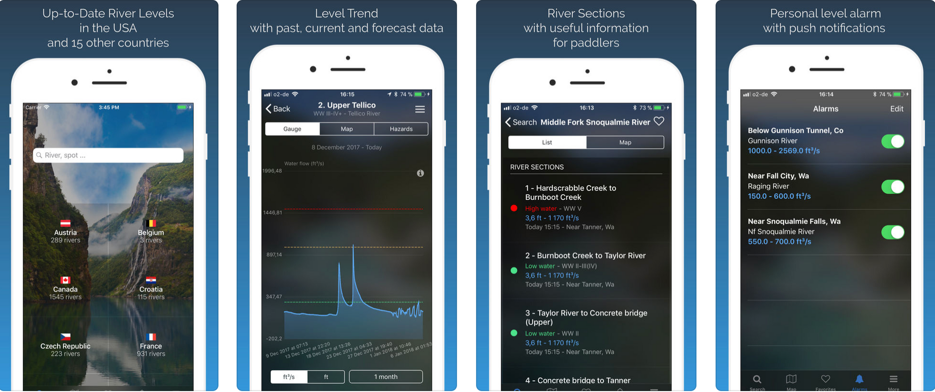
The River App (Apple/Android) Available for Apple and Android, this app is a must for all river people. You're able to favorite the rivers you check regularly which puts them in one convenient list making it easy for you to check them regularly. Much more manageable than having 50 windows open on your browser.


Websites
American Whitewater We love using AW as a river resource, it's easy to navigate and the data is well organized. Along with the flows they provide you with a little extra info such as put-in and take-out coordinates, directions, and permit restrictions or requirements. AW is probably the oldest (founded in 1954) non-profit river conservation organization on a mission to protect the remaining free flowing rivers. Their website is a wealth of river knowledge and we encourage, if you use them as a resource, to become an AW member and support their efforts!

